
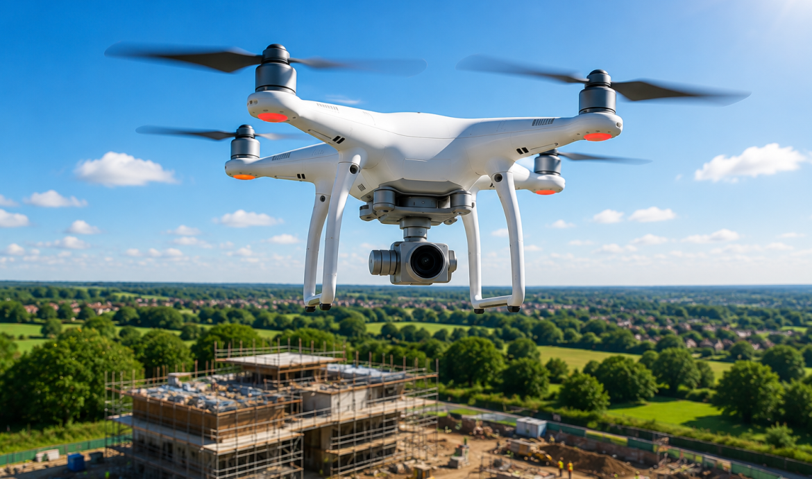
Drone Surveys
Safe, efficient and highly detailed aerial inspections for roofs, façades, land, construction sites and hard-to-reach areas, using high-resolution photography and video.
Detailed Aerial Inspections Without Traditional Access Equipment
Drone surveys provide a practical way to inspect buildings, roofs, land and construction projects from the air. They can capture detailed visual evidence without relying solely on scaffolding, cherry pickers or direct access to difficult and potentially unsafe areas.
One Stop Consult coordinates drone survey specialists to capture high-resolution photographs and video footage for review by clients, contractors, designers, surveyors and insurers.
The imagery can help identify visible defects, monitor progress, document existing conditions and support informed decisions throughout the life of a project.
What Can Be Inspected?
The survey scope is tailored to the property, site conditions, inspection objective and required outputs.
Roof Inspections
Detailed aerial review of pitched and flat roofs, coverings, ridges, valleys, flashings and visible defects.
Chimneys and High-Level Features
Visual inspection of chimneys, parapets, coping stones, roof plant and other areas that are difficult to access safely.
Façade and Cladding Surveys
High-level imagery of external walls, cladding, glazing, junctions and visible deterioration.
Construction Progress Monitoring
Regular visual records showing how a project is progressing across key stages of the build.
Land and Site Surveys
Aerial overview of development sites, boundaries, access routes, surrounding land and existing conditions.
Solar Panel Inspections
Visual review of solar-panel arrays, roof-mounted systems and surrounding areas for visible damage or access issues.
Common Uses for Drone Survey Imagery
A drone survey can provide useful visual evidence for a wide range of property, construction and maintenance purposes.
The footage can be reviewed directly or used alongside structural, condition, planning or insurance assessments.
Why Use a Drone Survey?
Aerial inspection can provide a fast, safe and cost-effective way to gather detailed visual information.
Improved Safety
Reduces the need for people to access roofs, façades and other potentially hazardous high-level locations.
Reduced Access Costs
May avoid or reduce the need for scaffolding, towers, specialist lifting equipment or temporary access arrangements.
Minimal Disruption
Surveys can often be completed with limited disturbance to occupants, neighbouring properties or site operations.
Detailed Visual Records
High-resolution imagery creates a useful record that can be reviewed, shared and retained for future comparison.
Large-Area Coverage
Buildings, roofs and development sites can be reviewed quickly from multiple angles and elevations.
Early Defect Identification
Visible issues can be identified sooner, helping clients plan repairs, further investigation or maintenance.
How the Drone Survey Process Works
Each survey starts with a review of the property, site conditions, inspection objective and any known access or operational restrictions.
Project Review
Confirm the property, inspection objective and intended use of the survey information.
Survey Planning
Review access, surrounding restrictions, flight considerations and required camera coverage.
Site Attendance
Attend the site and complete the planned aerial survey where conditions permit.
Image Review
Organise and review the captured imagery against the agreed survey objective.
Survey Output
Provide the photographs, footage or agreed supporting report for the project team.
What You May Receive
The exact deliverables depend on the agreed scope and purpose of the inspection.
High-Resolution Photographs
Detailed still imagery of the agreed inspection areas from suitable aerial viewpoints.
Video Footage
Smooth aerial footage providing wider context and a clear overview of the site or building.
Annotated Images
Marked-up photographs identifying visible defects or areas of interest where included within the service scope.
Condition Evidence
A visual record that can support maintenance, design, contractor or insurance discussions.
Progress Records
Date-specific imagery for comparison between different stages of construction or maintenance.
Specialist Review Support
Imagery suitable for review by structural engineers, surveyors, contractors or other relevant specialists.
Information Required for a Quotation
Provide the full site address, a clear description of the areas to be inspected and the purpose of the survey.
Photographs, drawings, site plans, previous reports and details of any known access restrictions are also helpful when preparing the survey scope.
Nationwide Drone Survey Services
One Stop Consult coordinates drone surveys for residential, commercial, industrial and construction projects throughout mainland UK, subject to site suitability, access, operational restrictions and appropriate survey conditions.
Other Services Your Project May Require
Drone imagery is often used alongside condition, structural, planning and construction services.
Important Drone Survey Information
Drone surveys are subject to site access, weather, visibility, surrounding hazards, operational restrictions and applicable flight requirements. Aerial imagery records visible conditions only and may not identify concealed defects or replace intrusive inspection where further investigation is required. One Stop Consult provides consultancy and coordination support through its specialist survey network.
Drone Survey FAQs
What is a drone survey?
A drone survey uses an unmanned aircraft and high-resolution camera to capture aerial photographs or video of a building, roof, site or hard-to-reach area.
Can a drone survey replace scaffolding?
It can often reduce the need for scaffolding where the objective is a visual inspection. Physical access may still be required for repairs, close examination or intrusive investigation.
Can you inspect a roof without accessing it?
Yes, subject to suitable site and flight conditions. The drone can capture detailed imagery of many roof areas from multiple angles.
What happens if the weather is unsuitable?
Strong wind, rain, poor visibility or other unsuitable conditions may require the survey to be rearranged.
Will I receive photographs and video?
The agreed outputs can include high-resolution photographs, video footage, annotated images or supporting reporting, depending on the quotation.
Can drone imagery be used for an insurance claim?
It can provide useful visual evidence of visible conditions. The insurer should confirm its specific evidence and reporting requirements.
Do you provide drone surveys nationwide?
Yes. We coordinate drone surveys for eligible projects throughout mainland UK, subject to site and operational suitability.
Request Your Free Drone Survey Quote
Complete the form below with the site address, inspection areas and purpose of the survey. Upload any photographs, drawings or previous reports so our team can review the requirement and coordinate an appropriate quotation.